The most unforgettable thing about a memorable visit to Katarraktis was the almost vertical wall of the Tzoumerka mountains to the east. I hardly took my eye off them. There’s a reasonably easy route to the ridge, possible I would think to ride on a mountain bike. A trail that zigzags up to the refuge, tucked away behind an outcrop at 1650 metres. The ridge is another 4-500 metres up. On Saturday night, through my binoculars, I could see a light up there. I don’t think it could be from the refuge, as that is hidden by the rocky outcrop. Maybe a camper. Certainly the weather was good enough. It just succeeds in making me envious, and is another entry to my list of missions once fully functional. It’s possible, relatively easily having gained the height, of about 2100 metres, to spend several hours on the ridge, taking in a few summits. A superb day.
On Sunday morning I knew the weather would break. Roja and I took in another circular tour of the village before a late morning coffee, and a few drops of rain. We left just after midday, with the plan to drive for a couple of hours. However, the rain set in quite furiously, and the cloud descended. I’ve mentioned it before, but the roads here become quite dangerous in heavy rainfall, with frequent rockslides, and sand and mud on the road.
At the small village of Tetrakomo, after only an hour’s driving, I called it a day, and settled in to read, and watch the rugby. It rained heavily until the early hours.


I was heading for the town of Karpenisi. Actually, my next destination is the Kravara, as Patrick Leigh Fermor refers to it, mountainous Nafpaktia in central Greece, called Kravara during the Ottoman occupation. It is surrounded by huge mountain ranges, the main features being the mountains of Tsakalaki, Xerovouni and Tsekoura reach an altitude of 1,731 m, as well as rivers, gorges, streams, waterfalls and (artificial) lakes.
But first to Karpenisi. The journey was 101 miles, and took almost 4 hours. The roads continue to be amazing to drive on. Today just about took the prize. I lost count of the number of passes I headed over. Frequently up to 1200 metres and down again to 400 metres. Progress was slower than usual as there was the expected debris on the road, some of which even required me moving them.
At Vragkiana the road turned from asphalt to just a track. After my experience a few days ago, I stopped and called into the village cafe to see if anyone knew what condition it was in. The young woman behind the counter assured me it was just 6 kilometres, steep and loose in places, but passable. She forgot to add the three stream, or river, crossings.. but she was right, it was passable. Just about..


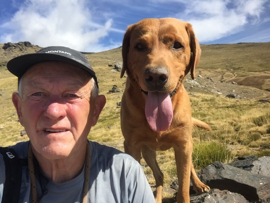
My actual destination was 10 kilometres from Karpenisi. To the north the road climbs another 800 metres from the town, which itself is at 1000 metres, to a rarely used ski resort.

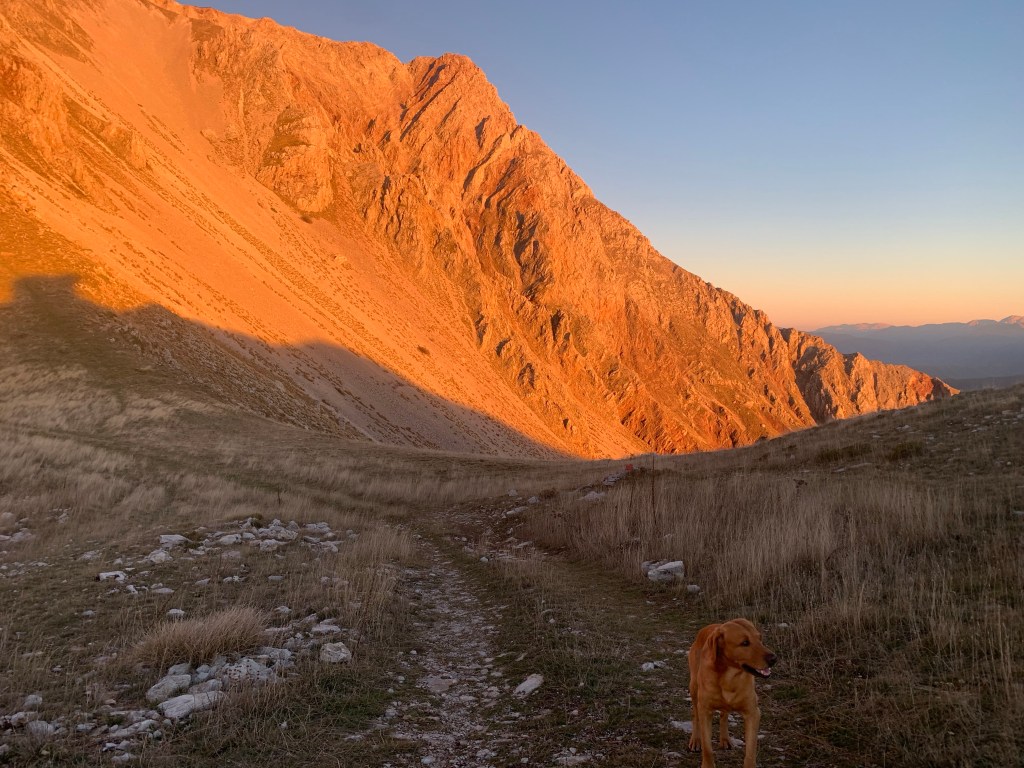

We arrived there just after 4 pm, and headed straight out to walk, and gain some more height. Our timing was perfect, we got up to a minor peak at 2100 metres just as the sun was going down. It was a superb end to the daylight of what had been a tiring driving day. I think the pictures speak for themselves.


Leave a comment